LinkedIn Newsletter / Contact Us RSS Feed Twitter Facebook
  • Menu
  • About
    • Attend an Information Session
    • Why Climate and Society?
    • The Climate and Society Team
    • Affiliated Institutions
  • Curriculum
    • Core Courses
      • Dynamics of Climate Variability and Climate Change
      • Quantitative Models of Climate-Sensitive Natural and Human Systems
      • Managing and Adapting to Climate
      • Regional Climate and Climate Impacts
      • Applications in Climate and Society
    • Electives
  • Admission
    • Tuition & Fees
    • Financial Aid
    • FAQs
  • Faculty
    • Core Faculty
    • Affiliated Faculty
  • Students
  • Alumni
    • C+S Alumni Board
  • Hot Topics
  • Contact
    • Email Updates

Millenium Villages Project

This is Why GIS Spatial Analysis is Special

by Climate and Society|October 13th, 2016

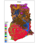
Have you ever used GIS to analyze data? GIS — short for Geographic Information System — is a mapping tool that be used to turn datasets into useful information.

Categories: Student Voices
Tags: data, GIS, Internships, Millenium Villages Project
  • Video-Icon

  • Categories

    • Alumni Voices
    • Featured C+Ser
    • Featured Faculty
    • News
    • Student Voices
    • Uncategorized
  • Tweets by @ColumbiaCS
This website uses cookies as well as similar tools and technologies to understand visitors' experiences. By continuing to use this website, you consent to Columbia University's usage of cookies and similar technologies, in accordance with the Columbia University Website Cookie Notice.Close